"What about residences on the lake whose docks become unusable below 1,099 feet?"
That question sits in Chelan County PUD's own public FAQ about lake levels, phrased almost apologetically, as if the utility knows it is naming a problem it created and cannot fully solve. It is worth sitting with for a moment, because it says something most waterfront listings never will: on Lake Chelan, whether your dock touches water is not a matter of weather. It is a matter of elevation, and elevation is a policy decision made by a public utility operating under a federal license.
If you are comparing waterfront properties in Chelan against listings elsewhere in the valley, this is the mechanism that changes the math. Two homes can sit at the same price per foot of lake frontage and offer completely different amounts of usable water across a year, and nothing on the MLS sheet will tell you why.
The Lake Runs on a License, Not Rainfall
Lake Chelan looks like a natural alpine lake, and in geologic terms it is one, but it has operated as a managed reservoir since the early 1900s. Chelan County PUD runs the Lake Chelan Hydroelectric Project under a license from the Federal Energy Regulatory Commission, formally FERC Project No. 637. The current license was issued on November 6, 2006, and runs for 50 years, putting its expiration in 2056. It is the third license the project has held, following originals issued in 1926 and 1981.
That license sets the boundaries the PUD has to operate inside. Full pool, the level most people picture when they think of Lake Chelan in July, has been defined by the project license as 1,098 feet since the earliest license was issued. The project's absolute ceiling is 1,100 feet. Its floor, the minimum the license allows in a drawdown, is 1,079 feet. Every foot of shoreline access, every dock, every boat lift on the lake exists somewhere inside that 21-foot band, and where a given property sits inside it is not decided by nature. It is decided by a negotiated settlement among the PUD, state and federal agencies, tribes, and local stakeholders during the project's relicensing process between 1998 and 2003.
Four Numbers on Every Chelan Lake-Level Chart
| Elevation | What it represents |
|---|---|
| 1,100 ft | Project maximum under the FERC license |
| 1,098 ft | Full pool, the summer high defined by license since the 1920s |
| 1,090–1,098 ft | The PUD's own definition of "usable lake levels for recreation," which the utility says varies by shoreline slope and dock configuration |
| 1,079 ft | Minimum drawdown elevation allowed under the license |
Notice that middle row. The PUD does not claim a single number produces usable recreation lakewide. It explicitly says the number depends on the shape of the shoreline in front of a given property and how the dock or lift was built. That is the detail a listing photo taken at full summer pool cannot show you.
The Cycle Nobody Puts on a Listing Sheet
Lake Chelan follows a repeating annual rhythm. The PUD generally begins drawing the lake down in late summer to create storage capacity ahead of fall precipitation and spring snowmelt, with the level typically falling below the upper-lake dock-access threshold of 1,096 feet sometime in September or October. A Lake Chelan Mirror piece on the ritual describes what that looks like on the ground each fall: dock lines that were snug in July suddenly sit too tight, boat lift cradles stop kissing the hull until you lower them an extra notch, and shoreline owners spend a few weeks in October making the small adjustments that come with a lake stepping down toward its winter range. None of it is an emergency. It happens every year, on a schedule the PUD sets months in advance and the community has come to expect.
The lake refills the following spring on snowmelt, typically crossing back above the 1,096-foot mark for upper-lake dock access sometime between mid-May and early June, faster in heavy snow years, slower in dry ones.
When Owners Pushed Back: The 2011 Precedent
This is not a settled, invisible process. In the spring and summer of 2011, after an unusually large snowpack delayed the lake's refill well past its usual date, Chelan-area property owners raised the issue directly with the PUD. That conversation led to a formal, ongoing public process between the utility and community leaders to evaluate lake-level concerns, one that continues today through the PUD's published lake-level discussions and annual compliance reports filed with FERC. The takeaway for a buyer is not that the system is broken. It is that the number governing your dock has a documented history of being renegotiated by people in exactly your position, and that history is a matter of public record.
Why the Same Price Per Foot of Frontage Doesn't Mean the Same Season
Here is the part that actually changes a buying decision. The City of Chelan's own Shoreline Master Program documents how much the water's edge moves depending on where you stand. In some steeper, rockier stretches of shoreline, the winter water line sits only 40 to 80 feet landward of the summer high-water mark. In other, shallower shelf areas, that same seasonal drop can push the water's edge back 100 to 150 feet, and in the flattest sections, more than 1,000 feet.
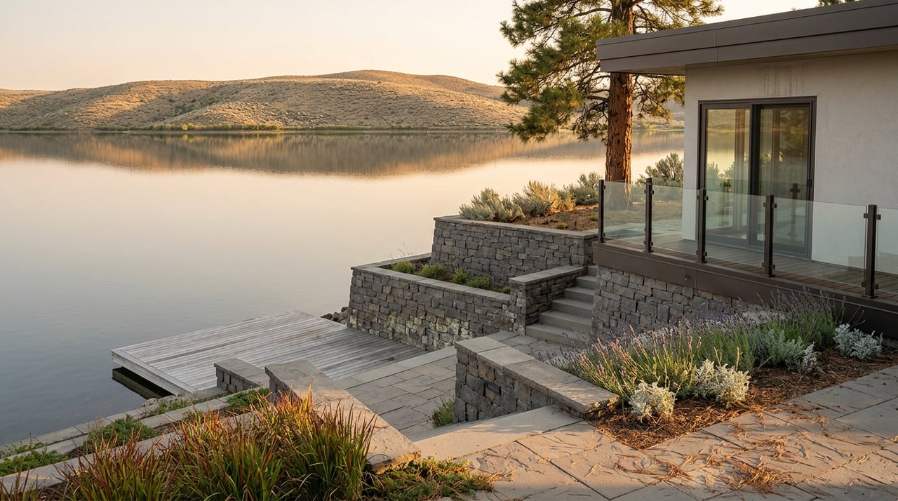
Translate that into two waterfront listings sitting side by side. A property on a steep, rocky shoreline can lose several vertical feet of lake level and barely notice, because the drop plays out over a short horizontal run. A property on a gentle, shelving shoreline can lose the same few feet and watch its dock strand itself on exposed lakebed for months, because that same vertical drop plays out over a much longer horizontal run. Both listings can carry an identical price per foot of frontage. Only one of them keeps its dock wet through a normal drawdown.
What This Means If You're Comparing Lake Chelan Waterfront Listings
Before treating "waterfront" as a single, comparable category across listings, it is worth asking a few specific questions that a listing sheet alone will not answer:
- What is the elevation at the base of this specific dock or boat lift, not just the general shoreline?
- Is the shoreline in front of this property steep and rocky, or a gentler shelf that runs a long way out at low pool?
- Was the dock or lift engineered to reach water at the lower end of the PUD's usable range, around 1,090 feet, or does it assume full pool conditions near 1,098 to 1,100 feet?
- What does the PUD's published lake-level history show for the specific months you'd want to use the dock most?
Chelan PUD publishes real-time and historical lake-level data publicly, along with elevations at the base of public boat ramps around the lake, so this is verifiable before you write an offer, not something you discover the following October.
Frequently Asked Questions
Does the fall drawdown affect every property on Lake Chelan the same way? No. The vertical drop is the same lakewide in any given year, but how far the water's edge retreats horizontally, and whether a specific dock keeps touching water, depends on that parcel's shoreline slope and where the dock structure sits within the elevation range.
Is the lake-level schedule identical every year? No. The PUD manages within its license floor and ceiling, but the actual path in a given year depends on snowpack and runoff forecasts. A heavy snow year can push the spring refill later, as happened in 2011, while a light year can allow an earlier, higher hold through summer.
Where can a buyer check current and historical lake levels directly? Chelan County PUD maintains a public lake-level page with real-time readings, a downloadable history, and a lake-levels FAQ that addresses dock-specific questions directly.
The Takeaway
A Lake Chelan waterfront listing tells you the price and the frontage. It does not tell you the elevation at the base of the dock, the slope of the lakebed behind it, or how that combination behaves when the PUD steps the lake down every October under a license that has governed this lake since before most of the homes on it were built. That is the number worth asking for before the one on the sign.
If you are weighing waterfront properties on Lake Chelan and want someone who checks that elevation before you fall in love with the photos, Valley & View works this shoreline year-round, on both the sales and the ownership side. Start your Lake Chelan property journey, buy, sell, or manage, with a team that already knows which docks hold water in November.